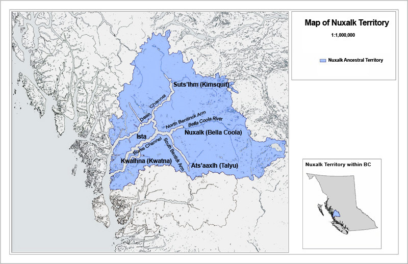
Nuxalk Territory Maps

The Territory of Our People is Vast


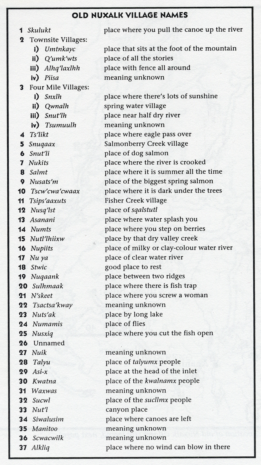
Nuxalk Territory includes many villages that
are located throughout Kulhulmcilh (Our Land). The largest villages are:

Talyu in Ats'aaxlh (South Bentinck)

Suts'lhm (Kimsquit)

Satskw' (Kimsquit River)

Nutl'l (Dean River)

Kwalhna

Q'umk'uts' (the village near what is known today as Bella Coola)

Knowledge of family ancestry remains strong
in Nuxalk families, including villages of descent, family crests, as well as songs and dances that tell the histories of our people in our Smayustas.

We, the Nuxalk, maintain our rights and title
to our entire traditional territory and continue
to strive to maintain our traditional systems of governance and powers, citing a long and rich cultural history as evidence of our continued
use and occupation.


Left: "Bella Coola Region 1883."

This map was published in W. F. Tolmie, and G. M. Dawson, "Comparative Vocabularies of the Indian Tribes of British Columbia" (1884).

This early map of the Nuxalk Nation Territory includes villages of the Dean and Kimsquit Rivers at the head of Dean Channel, on the Bella Coola River at the head of North Bentinck Arm, on South Bentinck Arm at Talleomey, and at Kwatna Bay off Burke Channel. It also includes King Island and the fjord where Ocean Falls is located.

Nuxalk Territory lies approximately between 52-53' North latitude, and 126-127O50' West longitude.

The Nuxalk People have as neighbours to the North, West and South various branches of the Kwakwaka'wakw speaking Peoples and to their East, the Athapaskan speaking Carrier and Chilcotin Peoples.

Ethnologist Franz Boas recorded 29 Nuxalk villages in his work published in 1898. T. F. MacIlwraith, who worked with the Nuxalk People in the 1920's, recorded 45 Nuxalk villages.

Photograph of Q'umk'uts' (Bella Coola) c. 1920

Above: Location of Nuxalk Villages (click to enlarge).

Right: Old Nuxalk Village Names (click to enlarge).

Above: Nuxalk Village of Sts'kiilh (click to enlarge).


Painting of how Q'umk'uts' (Bella Coola) might of looked c. 1873.
Artist Gordon Miller used historical photos to imagine the scene.


Left: Bella Coola,
British Columbia,
Canada

Topographical map
published in 1989 by the Canada Centre for Mapping, the Department of Energy,
Mines and Resources

Copyright Her Majesty
The Queen in Right of
Canada

Scale: 1:250 000

Double click for high
resolution, to see the
location of the Nuxalk
Indian Reserves (0.1 percent
of the 1,800,000 hectares
of Nuxalk Territory)


NUXALK STRONG – NUXALK FOREVER

Nuxalk Smayusta Homepage